The update of the Nantahala-Pisgah Forest Plan has been in the works for several years, and in February, the new draft Forest Plan and Draft Environmental Impact Statement (DEIS) were released to the public. The comment period for these documents closed on June 29, 2020.
Every national forest has a Forest Plan, which guides decisions about logging, recreation and other activities for approximately 15-20 years. Plans separate the forest into management areas and include rules for what activities can and cannot be done within those management areas (e.g. logging, road-building, etc.). Individual projects are then planned to implement various activities in specific locations. All projects must fall within the guidelines set forth in the overall Forest Plan, so it’s important to have strong guidelines from the beginning to help reduce or prevent conflicts with individual project plans.
The Nantahala-Pisgah National Forest includes the headwaters of the Wild & Scenic Chattooga River. The Chattooga Conservancy’s interests for this national forest are therefore primarily focused in this area, but we share several big-picture priorities with partner organizations that benefit the overall health of the forest.
Congressional designations

The Forest Service should recommend all potential Wilderness Areas to Congress for permanent protection as Wilderness or National Scenic Areas. In the Chattooga River watershed, this includes:
- Ellicott Rock Extension Area– Recommend for Wilderness designation
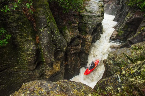
This 824-acre area is contiguous with the western boundary of the existing Ellicott Rock Wilderness. - Overflow Creek Wilderness Study Area – Recommend for Wilderness designation
Overflow has some of the most remote and secluded areas in the Nantahala National Forest, including high elevation rock outcrops, cliffs, waterfalls and old growth forests. Wilderness designation would protect the area’s outstanding and abundant opportunities for solitude. The area provides many remarkable opportunities for primitive and unconfined recreation, including wildlife observation, hiking, backpacking, hunting, horseback riding, fishing and camping. - Terrapin Mountain We were disappointed to find that the Forest Service excluded the Terrapin Mountain area from potential wilderness consideration in the draft plan and DEIS. The Terrapin Mountain area is a 5,450-acre area of rich biological diversity that includes the Chattooga Cliffs and portions of the Chattooga Wild and Scenic River corridor. The Forest Service should review and correct their mistakes in their evaluation of Terrapin Mountain’s wilderness characteristics.
- The Terrapin Mountain area includes impressive granitic domes and rare plant and animal communities, and supports high quality waters and diverse aquatic communities.
- The area offers outstanding opportunities for solitude and unconfined/primitive recreation.
- An important wildlife corridor connects the Terrapin Mountain area to the Ellicott Rock Wilderness Area. The Forest Service has argued that private land inholdings prohibit the wildlife corridor, but much of this land has been acquired by the Forest Service, and under the Eastern Wilderness Act, adjacent private land ownership patterns should not be the sole negating factor for an area’s size and manageability as a wilderness area.
Wild & Scenic Rivers
We support the Forest Service’s inclusion of 9 newly eligible streams for Wild and Scenic River (WSR) recommendation, including Overflow Creek, the Whitewater River, and the Thompson River. Portions of these three streams were recommended for Scenic or Recreational designation. However, we are asking the Forest Service to reevaluate the eligibility of these streams and upgrade their recommended designations to a higher level of protection:
- Overflow Creek – Upgrade eligibility from Scenic to Wild
- Whitewater River – Upgrade eligibility from Scenic to Wild
Specifically, the section starting just below the private land tract above the Democrat Creek confluence and running to the SC state line should be upgraded to Wild, with the exception of a Scenic corridor around the Highway 281 crossing. - Thompson River – Upgrade eligibility from Scenic/Recreational to Wild/Scenic
Also, the Forest Service did not find the East & West Forks of Overflow Creek eligible for WSR recommendation. We disagree with their assessment and believe the Forest Service should reevaluate the East & West Forks of Overflow Creek and recommend these creeks for WSR designation:
- The East & West Forks of Overflow form the headwaters of Overflow Creek in the Nantahala Ranger District, and are “outstanding resource waters” located in some of the wildest lands in the Chattooga River watershed; and
- They provide critical habitat for southern brook trout, a species that is in severe decline due to the effects of climate change, the impacts of Hemlock Woolly Adelgid, and outright habitat destruction/degradation. Due to the ongoing impacts of climate change, the best way to protect brook trout’s critical habitat is through the protective designation of the Wild & Scenic Rivers Act.
- We recommend the following:
- East Fork Overflow: Recreational classification from source to private land/national forest border above Glen Falls; Scenic classification from private land/national forest border to the West Fork Overflow confluence.
- West Fork Overflow: Wild classification from source to 0.25 miles above Blue Valley FS Road crossing; Scenic from 0.25 miles above Blue Valley FS Road crossing to the East Fork Overflow confluence.
Old Growth
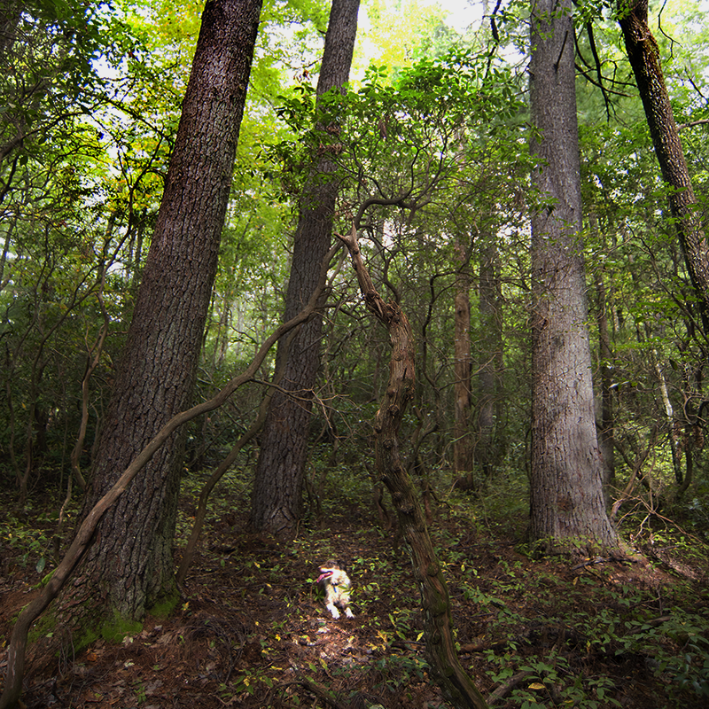
The Nantahala-Pisgah Forest Plan must increase the acreage of protected old-growth forest. The plan alternatives for old growth are based on flawed analysis and all fall short of protecting enough of this critical habitat. We are specifically requesting the following:
- All existing old growth, including inventoried stands and those that are discovered during project planning, must be added to the patch network;
- Backcountry, wilderness, and other similar areas must be included in the old growth patch network; and
- All priority conservation lands (Mountain Treasure Areas, State Natural Areas, and Existing old growth) should be placed into management areas that contribute toward future old growth.
State Natural Areas
All Natural Heritage Natural Areas are unsuitable for timber production and should be placed in management areas that assure they will be managed consistent with the values that led them to be designated by the State.
- State Natural Heritage Areas should be managed only to maintain their rare or exemplary ecological values.
Logging and Roads
Forest Service roads are the greatest threat to water quality in the Chattooga River watershed, and across the Nantahala and Pisgah, due to sedimentation and blockage of aquatic passages. Issues are often attributed to poor maintenance regimes, resulting from a lack of funding.
- Before the Forest Service increases levels of timber harvest, and thus expands road access, they must demonstrate progress toward reducing the road maintenance backlog and preventing the spread of invasive plants.
Logging itself can also contribute to significant sedimentation in creeks and streams.
- The Forest Service must prohibit ground-disturbing logging on steep slopes (40% or greater); and
- Stream buffers, including for ephemeral streams, must be at least as strong as those of surrounding national forests. Further, perennial streams buffers should be 100’; intermittent streams buffers should be 50’, and channelized emphemeral stream buffers should be 25’.
Climate Change
Consideration for the effects of climate change must be incorporated into all aspects of forest planning. We expect to see more frequent and intense storms, droughts, and fires, as well as migration of species to adapt to a changing climate over the coming decades.
- The national forest should be managed with focus on connectivity to provide migratory corridors for plants and animals. Roadless areas should be protected, and timber harvests and road construction should not create barriers to the movement of salamanders, aquatic organisms, or other species.
- All infrastructure must be designed and maintained to withstand increased storm intensity and frequency.
- The Forest Service should monitor disturbance trends across all lands in the planning area and commit to mitigating their impacts if unexpected levels of disturbance are occurring during implementation.
- The Forest Service should provide a full accounting of the Nantahala-Pisgah National Forests’ role in sequestering carbon, along with the cumulative impact of management and disturbance trends across the National Forest System.
or
Mail To:
Attn: Plan Revision Team
National Forests in North Carolina
160 Zillicoa Street
Asheville, NC 28801