

Editor’s note: this is a reposted article from the October 2025 issue of “Chattooga Currents.” We have chosen to republish the article to highlight this issue and its vital possibilities for the pristine Chattooga Headwaters.
“Wild,” “Scenic,” and “Recreational”:
Most Chattooga River enthusiasts are well-versed in the river’s Wild & Scenic designation: a federally protected river corridor extends ¼-mile from each riverbank, for 57 combined miles along the Chattooga’s main stem and West Fork.
But did you know there is not just one uniform “Wild & Scenic” classification, but rather three distinct categories of protection? These three classes: “wild,” “scenic,” and “recreational” were established in the 1968 Wild & Scenic Rivers Act. “Wild” river segments contain the least evidence of human development and the most remote qualities, and they have the most rigorous protections. “Recreational” river segments show the most evidence of human development and are the most easily accessible of the three protected classes, and they have the least rigorous protections. “Scenic” river segments fall in the middle for both development/access and level of protection. When rivers gain Wild & Scenic designation, one of the first tasks for the managing government agency is to delineate segments along that river and assign “wild,” “scenic,” or “recreational” classifications to each segment.
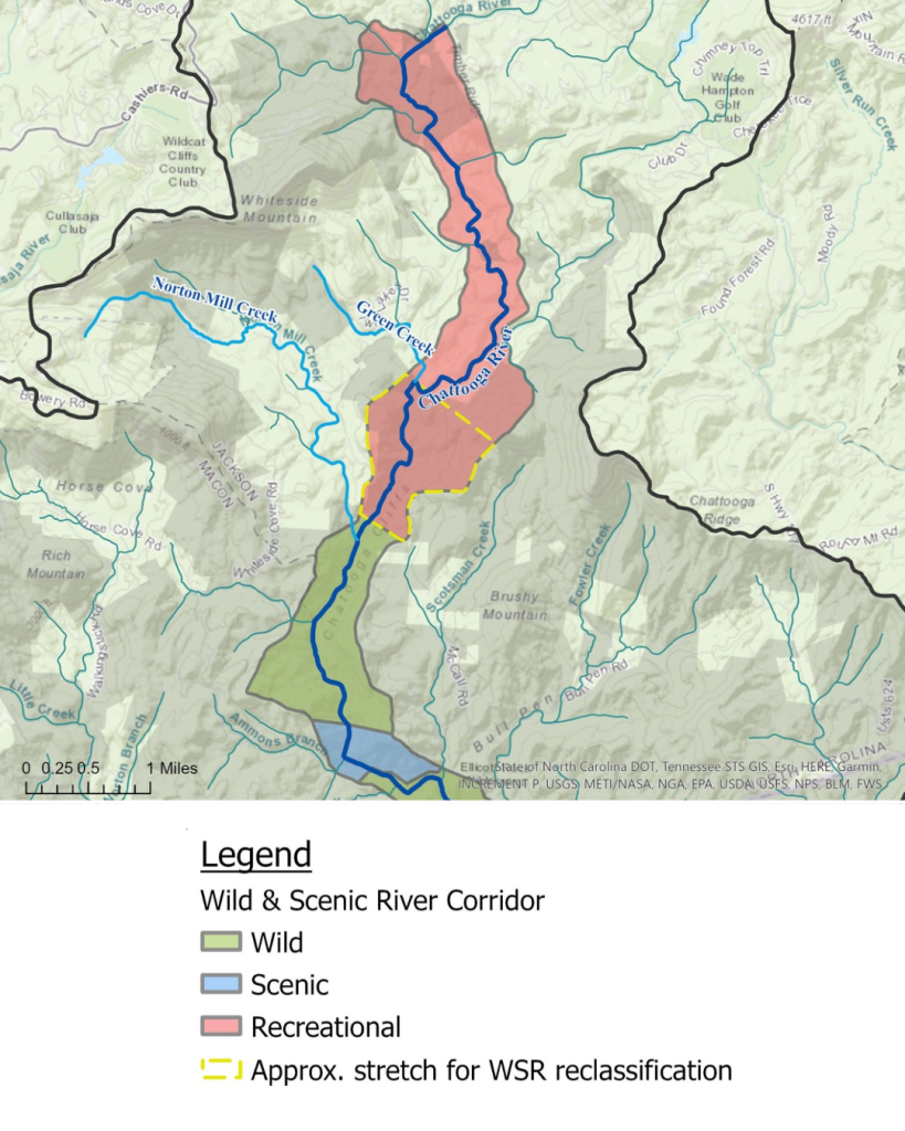
On the Chattooga, the “wild,” “scenic,” and “recreational” sections do not correspond to the river sections (I, II, III, IV) as commonly used by the whitewater and hiking communities. Rather, the US Forest Service (USFS) established 12 different river segments when they published the official Chattooga Wild and Scenic River Classification, Boundaries, and Development Plan in 1976. The classified segments are as follows, from upstream to downstream, often named for a defining feature or landmark in each segment: Headwaters, Chattooga Cliffs, Bullpen Bridge, Ellicott Rock, Burrells Ford, Rock Gorge, 28 Bridge, Earl’s Ford, 76 Bridge, Woodall Shoals, (and, on the West Fork:) 3 Forks, and Pine Mountain. In all, “wild” segments constitute approximately 70% of the river corridor; “scenic,” 4%; and “recreational,” 26%.
Chattooga Headwaters:
While the Headwaters section is remote and contains some of the most hidden scenic treasures in the entire Chattooga River corridor, this segment was designated “recreational” in 1976. The “recreational” designation deviated from an original USFS study recommending the Chattooga for Wild & Scenic designation that outlined a “scenic” classification for the Headwaters. It is likely that private land ownership inside the river corridor contributed to the final downgrade decision, because at that time, nearly all land bordering the Chattooga Headwaters was privately owned.
Now, however, we have a unique opportunity to strengthen protection for the Chattooga River. In 1979, USFS purchased a large tract of land in the Chattooga Headwaters, spanning both sides of the river from Green Creek to Norton Mill Creek. This means that of the 5.5-mile Headwaters section (beginning 0.8 miles below Cashiers Lake and ending 0.2 miles above Norton Mill Creek), 1.4 miles of undeveloped, remote river corridor now falls within publicly owned national forest land. Common sense dictates the need to reclassify the Green Creek to Norton Mill Creek segment of the Chattooga River as “wild” or, at the very least, “scenic.” It easily meets all the requirements for this classification: “free of impoundments and generally inaccessible except by trail, with watersheds or shorelines essentially primitive and water unpolluted” (Development Plan, 1976).
How Do We Accomplish Reclassification?
The ultimate authority for Chattooga reclassification lies with the USFS, which is the administering agency for the Wild & Scenic Chattooga River. The Wild & Scenic Rivers Act provides for amending designated river boundaries and classifications. To affect any modifications, the administering agency must publish notice of any such changes in the Federal Register, and the new boundaries will become effective after a 90-day waiting period (16 U.S. Code § 1274(b)). Publication in the Federal Register is the same process by which Chattooga boundaries and segment classifications were set forth in the first place, in 1976.
What Can You Do?
For now, join in building allies for this timely change: tell your friends about the ecological and scenic importance of the Chattooga Headwaters and about how reclassifying the Green Creek to Norton Mill Creek stretch would strengthen protection for this iconic reach. The more people enlisted to support this needed reclassification, the stronger the ultimate case is to the Forest Service!
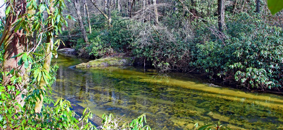
Header image: The serene and untrammeled Chattooga River corridor between Green Creek and Norton Mill Creek is overdue for an upgrade to a “wild” classification.