

Georgia
The Foothills Landscape Project is a sweeping forest management proposal from the U.S. Forest Service that could reshape a vast portion of the Chattahoochee National Forest. Spanning more than 157,000 acres—nearly twice the size of the city of Atlanta—it is the most consequential Forest Service project in northeast Georgia in more than 15 years.
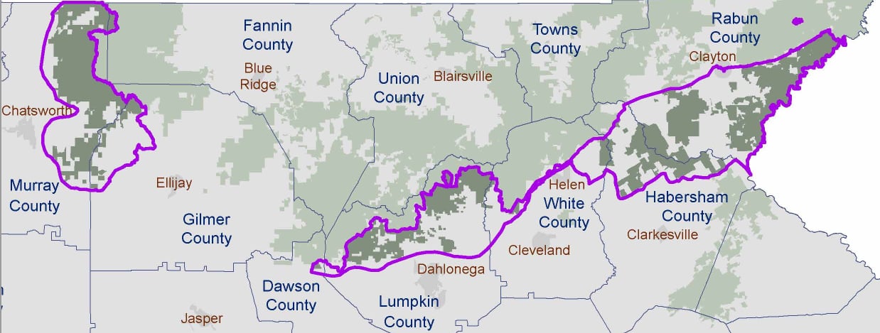
While the majority of the project area lies within the hills of Dawson, Fannin, Gilmer, Habersham, Lumpkin, Murray, and White Counties—aptly earning the name “Foothills Landscape Project”—a corner of the project extends up into the Blue Ridge Mountains around Clayton.
The section of the Foothills Landscape Project between Clayton and the Chattooga River south of Highway 76 has been labeled the “Lower Chattooga Implementation Area.” You can read about it and view the implementation plan below.
Despite formal objections in 2021 by Georgia ForestWatch, Chattooga Conservancy, Sierra Club, and The Wilderness Society, the Foothills Landscape Project has been approved. Therefore, some of the actions proposed for the Lower Chattooga Implementation Area are inevitable.
However, the Forest Service has committed to seeking ongoing public input, and has expressed willingness to tweak the boundaries for its treatments based on feedback from area stakeholders.
Although we continue to have strong objections to the FLP, the Chattooga Conservancy participates in the Foothills Collaborative as a member of the “Conservation Working Group” to represent the interests of our organization and advocate for preserving the ecological integrity of the Chattooga watershed ecosystems affected by Implementation Plan proposals.
To learn more about the Foothills Collaborative group, visit this webpage.
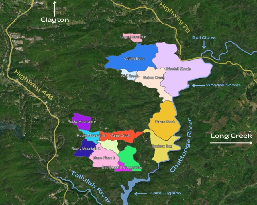
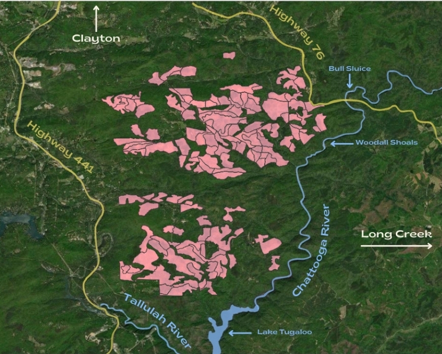
In late October 2025, USFS released a draft FLP Implementation Plan for the Lower Chattooga. The plan proposes actions beginning as soon as 2026 and continuing for the next decade. New timber treatments, including thinning, commercial harvests, and herbicide applications, are proposed for over 5,000 acres, and prescribed fire (on one-to-five- or three-to-five-year return cycles) is proposed for over 6,500 acres—although there is substantial overlap between the two, bringing the total affected area to approximately 8,500 acres.
If you would like to explore the specific treatments proposed for stands in the Lower Chattooga Implementation Area, visit our interactive map.
Map Instructions: from the basemap, select the layers icon on the left sidebar. Select the dropdown arrow next to “USFS Projects – Chattooga & Chauga Watersheds” to reveal “Foothills Project (GA),” which drops down to reveal sublayers for the “Lower Chattooga Implementation Area.” These can be further isolated into “Proposed Treatments” and “Proposed Burn Units.” Turn sublayers on or off by clicking the eye icon on the right side of the layer title. Click within the map to pull up information about a specific highlighted stand.